 |
|
|
| |
|
|
|
|
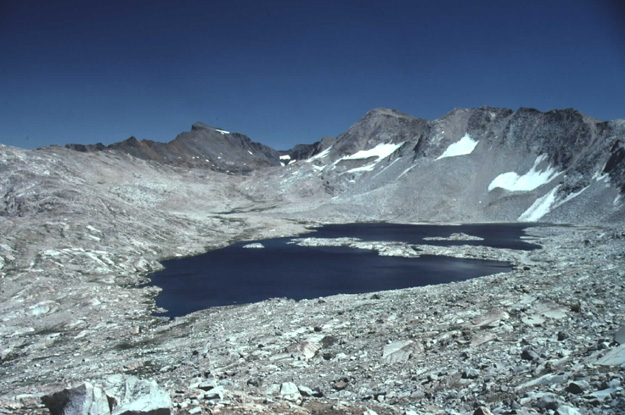
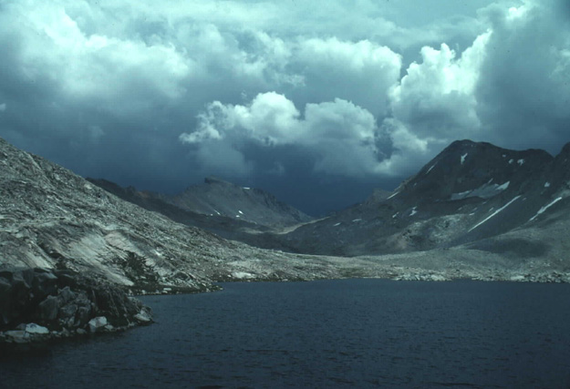
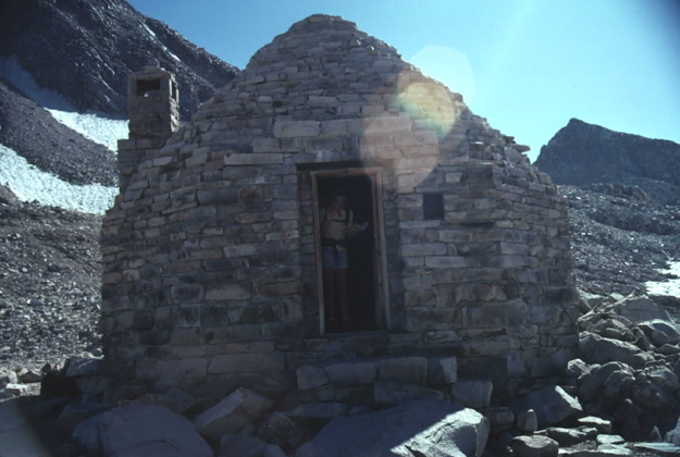
| The above picture was taken on the cross country route I did several years before trying to hike the full John Muir Trail, which comes up the canyon from the lower left before traversing the left hand side of Wanda lake. Lake McDermond is barely visible as a small blue area in the low spot above the lake, with Muir Pass the low spot of lighter color gray rock below the dark color peak. Below is how it looked when I was actually hiking the John Muir Trail. The Lake is named after one of John Muir's daughters. The two brothers I kept seeing off and on decided to camp near Lake McDermond because of the weather. I spent some time in their tent before deciding to make a go for it. About 15 minutes from the Pass a dark cloud started approaching and the rain picked up with some light hail. I started walking as fast as I could to make it to the hut, getting a headache from lack of oxygen. Just as I arrived at the hut the door opened for me. There were already 5 other people there waiting out the storm. From the lower picture you might get a better idea of where the pass is. Its about a 500 ft elevation gain to the pass which is 11,955 ft tall with the Mt Solomons on the right at 13,034 and Black Giant in the background at 13,330 ft. The small patch of snow on the side of Mt Solomons is a glacier, a small one. At least that's what the maps show. The map shows a lot of small glaciers in this area, mostly on the north and east facing slops.The last picture is Muir Hut located at the pass taken on the previous trip. I wasn't thinking too much about taking a picture in that weather. |
| |
|
|
