 |
|
| |
|
|
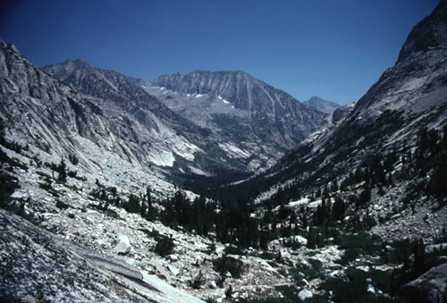
From Los Angeles you can reach either side of the Sierras. It might take awhile but it can be done. One area you could hike to using public transportation is shown above. By taking public transportation to Bishop you could get a shuttle that could drop you off at one of several trailheads leading to this area. For information on hiking permits in the area check out the Inyo National Forest Service website and look under FAQ's. LAX to Amtrak
- There is a free shuttle from the airport to the Metropolitan
Transit Authority's Light Rail. You'll be looking for the Metro
Green Line Light Rail's Aviation Station which leaves from the
Lower Level under the LAX Shuttle sign. The shuttle drops you
off at the Aviation Station where you'll be taking the Green
Line toward Norwalk. You'll transfer to the Blue Line at the
Imperial/Willmington station take it to the 7th Street Metro
Station where you'll transfer again to the Red line which you'll
take to the Union Station where you'll board Amtrak. You can
view a map of the light rail system here. To Merced and Yosemite - You'll be taking Amtrak to Merced where you'll board a bus to Yosemite which stops at the train station. Currently there are three morning buses and one afternoon bus leaving Merced for Yosemite. If you want to look at the schedule look for the Highway 140 bus. The route varies slightly depending on what time of day so don't expect it to stop at every stop. If you took Amtrak to Merced the bus will leave from the station. It makes a number of stops along the way. This is convenient for people working in the park or for tourist not wanting to drive to the park and have to find a parking space. The final destination is Yosemite Lodge however, if you want to connect with the bus to the east side of the Sierras you'll want to get off at the Visitors Center. The bus doesn't always stop there so you might have to make a special request with the driver. If you plan on backpacking in the park the driver will drop you off along the road. Of course you'll need a permit first. After you're through with your hike just stand along the road when the bus comes by and wave to get him to stop.
To trailheads on the eastern side - If you're heading to Mt Whitney you might be able to hitch hike from Lone Pine. I've hitch hiked in Yosemite with mixed results however, I've had excellent results hitch hiking along Highway 395. I had a backpack and had just finished hiking 175 miles so I looked the part however, two guys in Bishop that weren't backpackers and were just hitch hiking told me no one was picking them up. I was hitch hiking from south of Big Pine to Yosemite. My first ride took 30 minutes and the rest took about 15 minutes. If you don't want to hitch hike you can try this list of shuttles provided by the Parchers Resort, a horse packer station that supports backpackers near Bishop Pass. PERMITS: If you plan on backpacking you'll need a hiking permit. Permits for Yosemite are available at the Yosemite Valley Wilderness Center. There are some permits available on a first come first serve basis but I wouldn't count on it. Some of the more popular permits go fast and if you're not at the window when they open in the morning you could be out of luck for that day. It would be best to reserve on ahead of your arrival. Make your reservation early! If you want to hike to Mt Whitney you'll need a permit for the Mt Whitney Zone no matter where you started. Permits for other hikes along the eastern side of the Sierras can be obtained at one of various Ranger Stations. YARTS - Yosemite Area Regional Transportation System, they make runs from Merced to Mammoth and stop at several trailheads. RIDESHARE INFORMATION - transportation options in Merced County. Currently the airport is only serviced from Fresno by Scenic Airlines. At least that's what their website says. I can't find that airline listed for the Las Vegas Airport. FLY FRESNO - Information on the Fresno Yosemite International Airport, including a list of airlines that fly there. There is no public transportation to the Sierras but you can rent a car. EASTERN SIERRA TRANSIT AUTHORITY - Routes from the Reno Airport down highway 395 to Ridgecrest. KERN REGIONAL TRANSIT - Kern County has transportation between Mojave and Ridgecrest. Mojave can be reached by Amtrak's feeder bus or Greyhound. This route is no longer needed to get to the east side of the Sierras but you may have use for it anyway. RENO/TAHOE INTERNATIONAL AIRPORT - the airports website www.395.com - anything and everything having to do with the east side of the Sierras and highway 395. TRAILHEAD SHUTTLES - A Sierra Club site that list shuttle information for the highway 395 and to the trailheads. AMTRAK - Amtrak's homepage. Sometimes they'll put you on a bus that will connect to a train. For example, you'd travel by bus from Sacramento to Stockton Los Angeles International Airport Metro Transit Authority - Los Angeles Transit system |
| |
|
