 |
|
| |
|
|
|
|
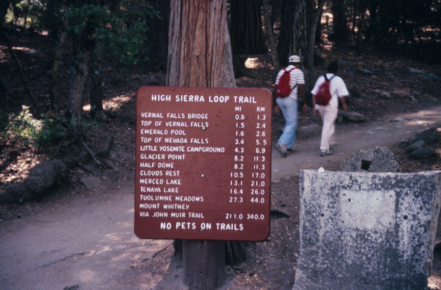
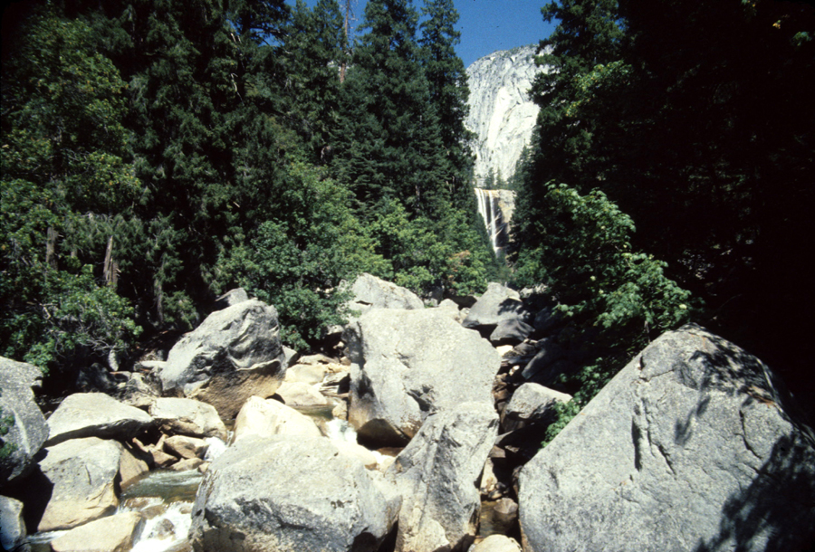
Starting from Happy Isles one of the first things you'll see is this sign. Many people only hike as far as the first bridge. A few hike as far as Mt Whitney. If you're hiking 10 miles a day, every day you'll make it to the top of Mt Whitney in about 21 days. I've hiked the route from Merced Lake to here at least 10 times. Its about 6 hours, and you'll be better off if you don't jump in a car and drive home right away. If you do you'll regret it at your first stop when you realize how much your legs hurt. Your body will like you a lot more if you spend a night and walk around. Below is the view of Vernal Falls from the bridge. This was at low water. Last stop for drinkable water, and restrooms. If you're continuing make sure you have water with you, and a filter. Just a few minutes from here is the trail junction with the John Muir Trail which takes you up the switch backs above the river. A much better route if you have a backpack. |
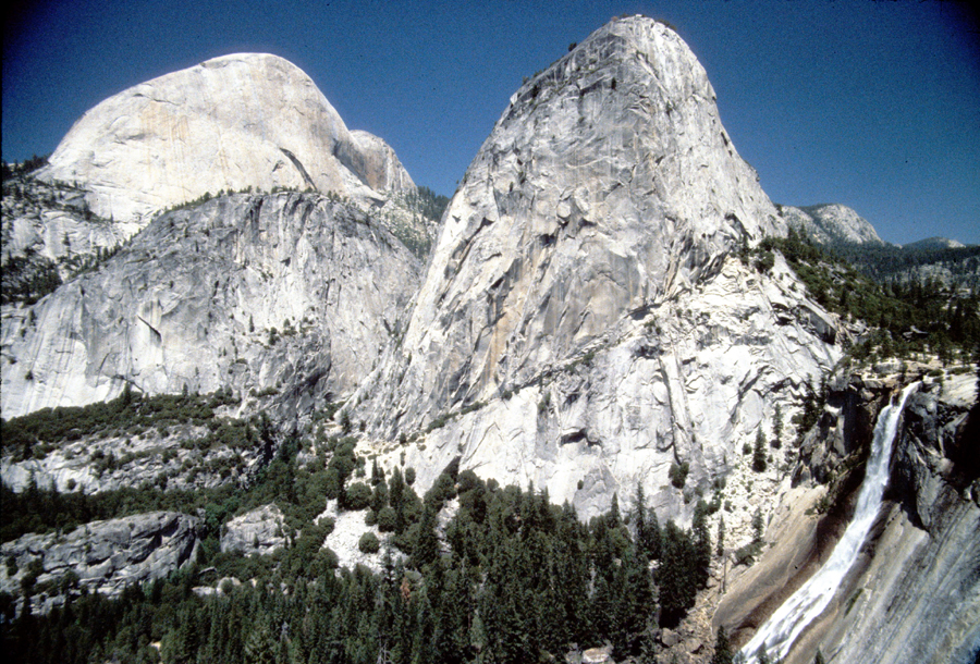
| On the left below is the back of Half Dome, with Liberty Dome in the middle, and Nevada Falls on the right. At the base of Liberty Dome there is a trail heading up to the top on the far side of Nevada Falls. This picture is taken from the John Muir Trail which meets up with that trail on the other side of the river. I read that the last person to go over the falls shot out quite a bit before he dropped to his death. Stay away from the top and you're biggest worry will be the California Gray Squirrels. If you don't watch your pack they'll chew a hole in it. |
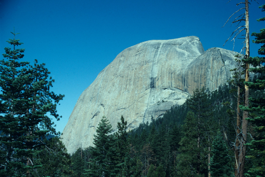
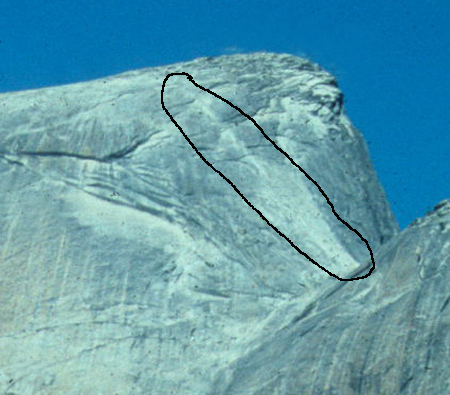
| The trail continues around the backside of Half Dome. Besides needing to carry plenty of water you'll also want to make sure you have the proper shoes. One person fell in 2007 and I've heard he had on dress shoes. Sandals aren't recommended either. You'll also want good leather gloves. They'll come in handy when you're trying to pull yourself up the cables that are set into the rock. The worst time to do this hike is the weekend, when people get backed up on the cables. The second picture below has the route circled. |
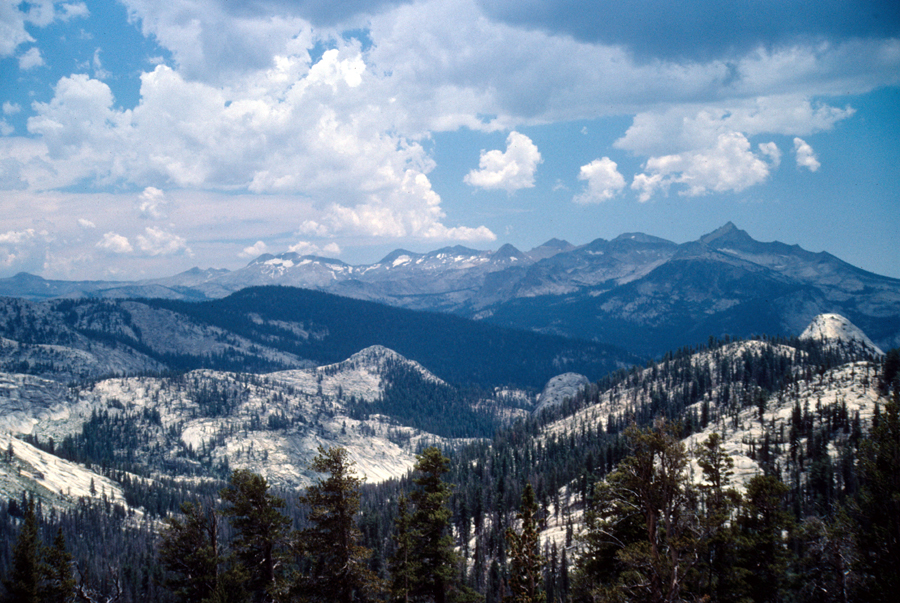
| Below is a view south looking over the Merced River toward the Clark Range, with Mt Clark on the right. Echo Creek is below to the left. I hiked it once and remember some nice pools in the creek. There's been a fire in the area since, but I'm sure its still worth the hike. |
| |
|
