|
|
|
|
|
|
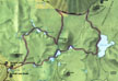
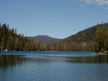
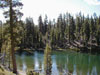
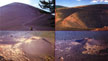
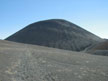
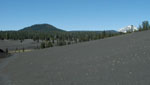
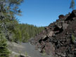
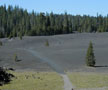
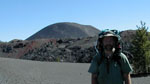
| This park is located about a 3 hour drive north of Sacramento, in the southern part of the Cascade Range. Most of the backpacking is done in the eastern half of the park, which has a different character than the western half. The Western half has the tallest peaks and the geothermal areas. While the eastern half has it's share of volcanic peaks, it still looks more like the typical forest. There are exceptions though, such as the area around Cinder Cone. The last eruption at Cinder Cone was during the winter of 1850 - 51. In 1851 William Nobles discovered the Nobles Emigrant Trail which skirted the base of the Cinder Cone. This trail was an alternative to that over the Donner Pass but did not see much use and was later abandoned. The trail is still visible and can be hiked. |

|
|