 |
|
|
| |
|
|
|
|
|
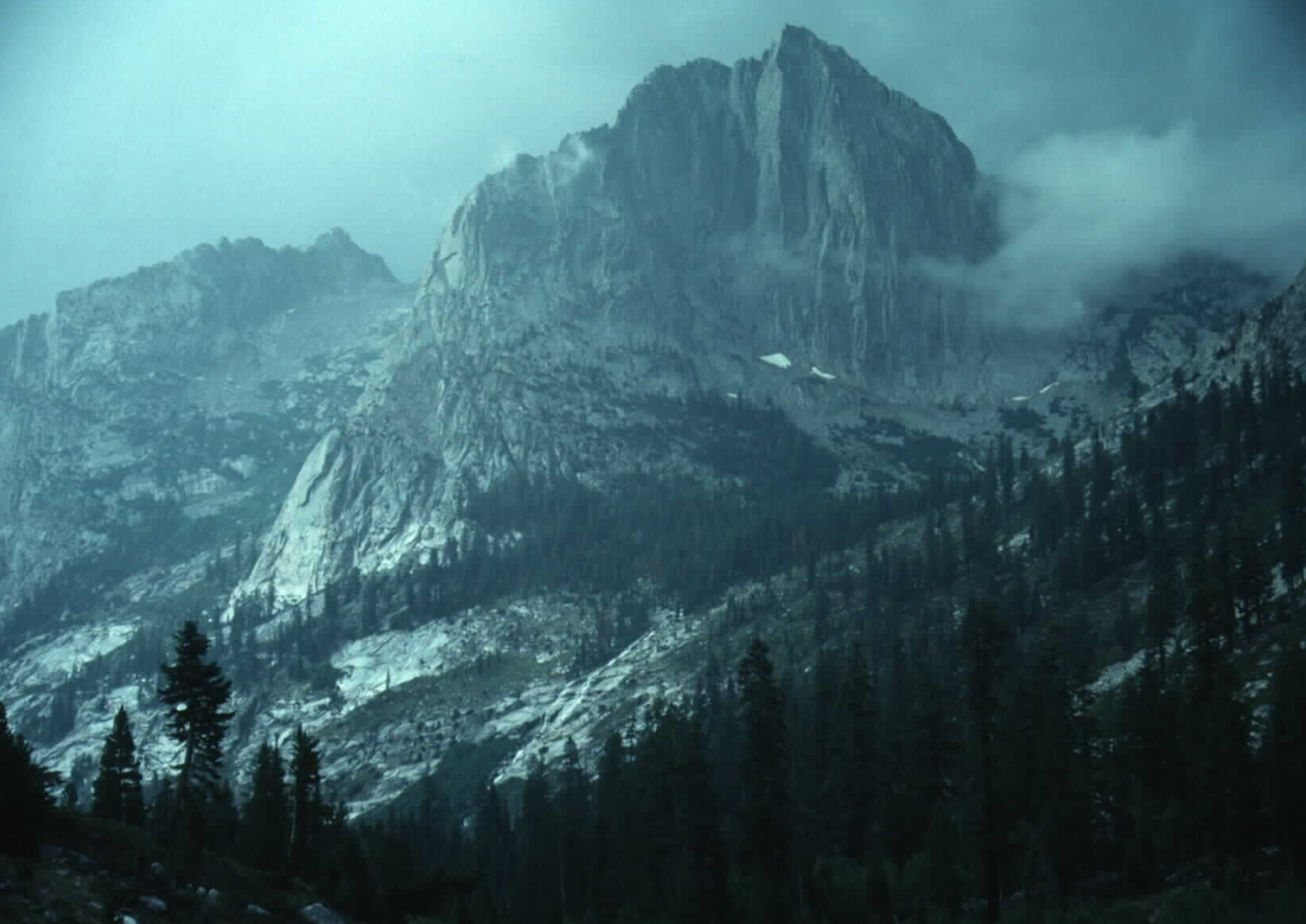
The John Muir Trail is one of the most memorable trails I've hiked, even if I didn't finish it. The trail extends 211 miles from Yosemite Valley to Mt Whitney. I managed to make it over Mather Pass before I pulled a muscle in my back. Another 67 miles and I would have finished. I ended up hiking 175 miles in 21 days. Since the trail Starts/Finishes at the top of Mt Whitney depending on which way you hike, the trail is actually about 221 miles since you have to hike the distance between the Whitney trailhead and the top of the peak, which happens to be the highest point in the Continental United States at 14,491 ft, a descent/climb of about 6000 ft. Incidentally, Death Valley National Park which has the lowest point in the Continental United States is in the same county. If you were really adventurous you could also do the Badwater Ultra Marathon run between the two points. Many hikers start in Yosemite Valley and hike southbound. There are several advantages to this. One is that you can hike lighter for the first part of the hike as food drops are closer together. It also allows you to get in shape as you hike before you hit the bit passes in the southern portion. There are only a couple advantage to hiking Northbound. One is that you'll be starting at a higher elevation so you'll be basically hiking downhill. The other is that once you suffer over the first part it can only get easier. The problem is that you'll probably end up having to carry food for the first 125 miles of the hike unless you have someone willing to hike in with food, or pay to have an outfitter bring it in. You could hike out to Parchers but that's still about 8 miles each way by way of Bishop Pass. By hiking southbound you can resupply after 25 miles at Tuolumne Meadows where there is a post office and a store. Another 25 miles brings you to Reds Meadow (Info for food drop is at the bottom of the page) at Devils Postpile National Monument. About another 30 miles brings you to the Lake Vermilion Resort which caters to hikers. Another 22 miles brings you to the Muir Trail Ranch, the last convenient food drop. At this point you'll be about 108 miles to go but you should be in excellent condition and carrying the extra weight shouldn't be a big deal by then. The unofficial official website for the trail is with the Pacific Crest Trail Association (PCTA). I don't see much need to cover all the details about the hike since they've already done it, and are more likely to have current info. One thing I'd like to remind people about is that you are REQUIRED to carry a bear canister in the national parks with no exceptions. The Ursack is NOT approved and its use could result in you're receiving a fine.There are a lot of problem bears along this route and I've talked to a few people that have had problems with them. This includes 3 people that I kept meeting on the trail while I was hiking the JMT. They had a bear chew through a limb to get their food out of a tree. Fortunately they were only about 4 miles from Tuolumne Meadows so they back tracked and got more food. Check in with the PCTA's website for any changes. before you hike. The best time of year to hike the John Muir Trail is a hard question. Ideally it would be best if you can be flexible with your start date since there is no ideal start date. It all depends on the weather. The best time to start is after most of the snow has melted, but not too long afterwards as some creeks will dry up. You don't want to start too soon as too much water means that some creeks will be hard if not impossible to cross. It all depends on how much snow the mountains receive, how much rain at high elevations, and how warm or cold it is in the spring. The best thing to do is to keep an eye on the weather and the snow depths. The state of California has an excellent website with automated snow survey equipment in several places in the mountains. Its conviently called the California Snow Page. Just remember that the snow depths are given in Inches of Water in the snow. This is done by measuring the weight of the snow on special pillows. This information is then sent via satellite to the states offices and is updated daily. One site recently said it had about 50 inches of snow while a physical measurement of the depths in that area resulted in about 120 inches of snow. We used to use a factor of 3 in the air force for dry snow so three inches of snow was equal to one inch of water. Some years you can start in early June and some years its best to just forget it. |


| |
|
|
